ASPHALT
moderate
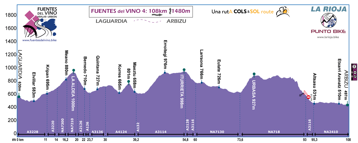
Stage 4
LAGUARDIA - ARBIZU
Distance: 108 / 96 km
Unevenness: 1.480 / 1.190 m
Cantabria Range, Montaña Alavesa and Urbasa Range. New landscape look at the last stage of Fuentes del Vino.

We leave behind the territory of the wineries and we enter the coal merchant’s territory. 5 bicycle touring stars for the road and forest paths of the mountains of Alava. 4 for the COL and the Urbasa Range (one less for a little more of traffic).
As the first stage, this last one also without excess.
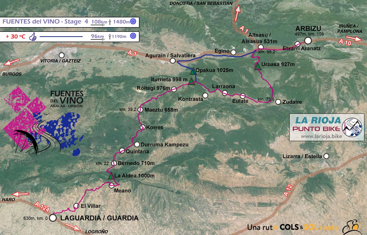
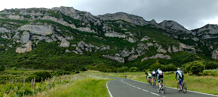
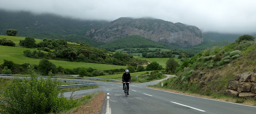
First section of the route, Laguardia - La Aldea. We should pass through the Sierra de Cantabria and fall on the other side, to the Montaña Alavesa.
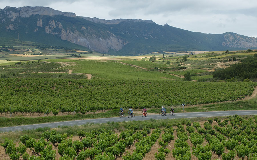
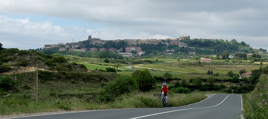
Last kilometres through vineyards. (Cicloturista Vitoria 2016)
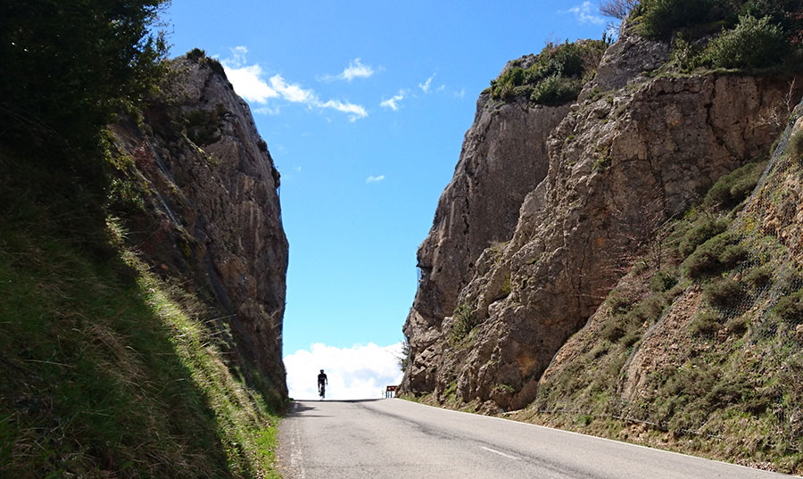
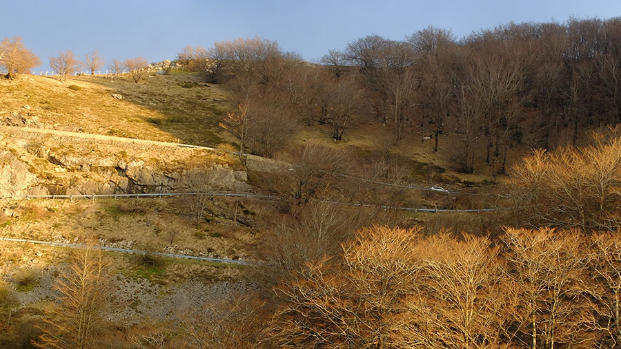
Rocky gap at the top of La Aldea mountain pass. Natural entrance to the Montaña Alavesa.
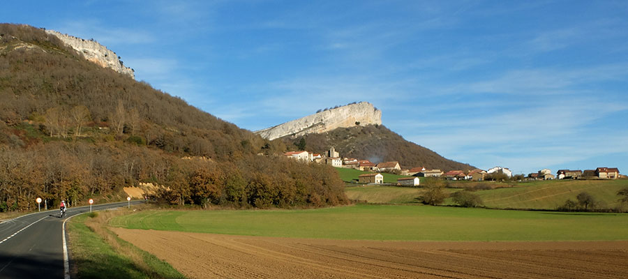
Montaña Alavesa in full. San Román de Campezo.
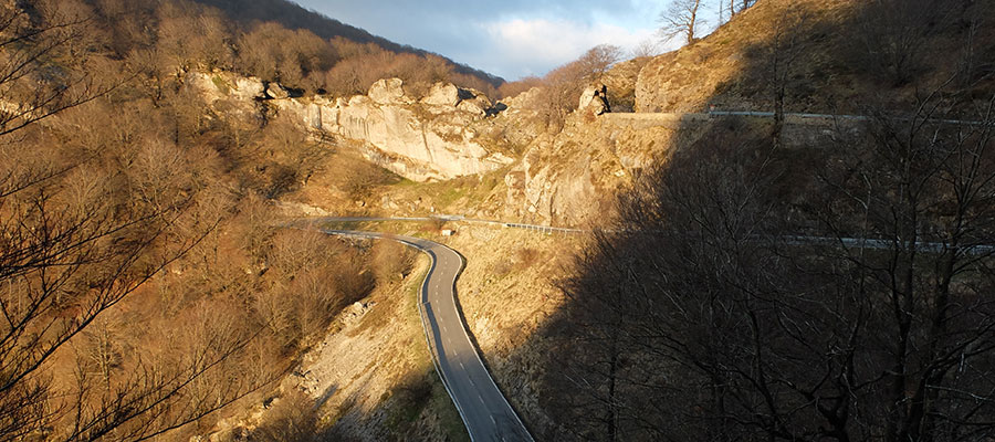
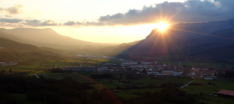
Descense of Urbasa mountain pass to Alsasua.
We go finishing the day. We are on top of Alsasua, between the Llanada Alavesa and the Barranca Navarra.
in preparation
If you want to see the route on wikiloc website click on the green icon on the map
Criteria used in the 6 levels that we have chosen for the ranking of the routes:
- Walks or family routes: Routes with light slopes and little travel. Suitable for untrained family groups or for people who usually don't use the bike
- Easy: Routes with a slope that can reach 1000 meters but facing none of the large ports.
The distance will range between 40 and 60 kilometers. - Moderate: Routes with one of the "great" ports or a combination of similar difficulty. The slopes can be really important and slopes can range between 1000 and 2000 meters.
The distance will vary between 60 and 100 kilometers. - Hard: Routes with a slope ranging around 2500 meters. There may have to ascend 2 ports of the "greats" or one and several of the "minor".
The distance will vary between 90 and 130 kilometers. - Very hard: Routes ranging from the 2500 and 4000 meters of altitude. Sometimes there may have to ascend the 3 ports of the '' greats ''.
The distance will exceed the 100 kilometers and may reach up to 200 km. - Challenge: In these times there is a public that demands "more" yet. To them arises the concept of "challenge": stages of more than a day in "non-stop" mode, 4500-5000 or even more meters of altitude routes, individual or group time trial with 3000 meters of altitude and over 100 kilometers of route.
Finally, a variety of what riders would usually call "nonsense" which to be more elegant, here we call it, 'Challenges'.
 Return