ASPHALT
hard
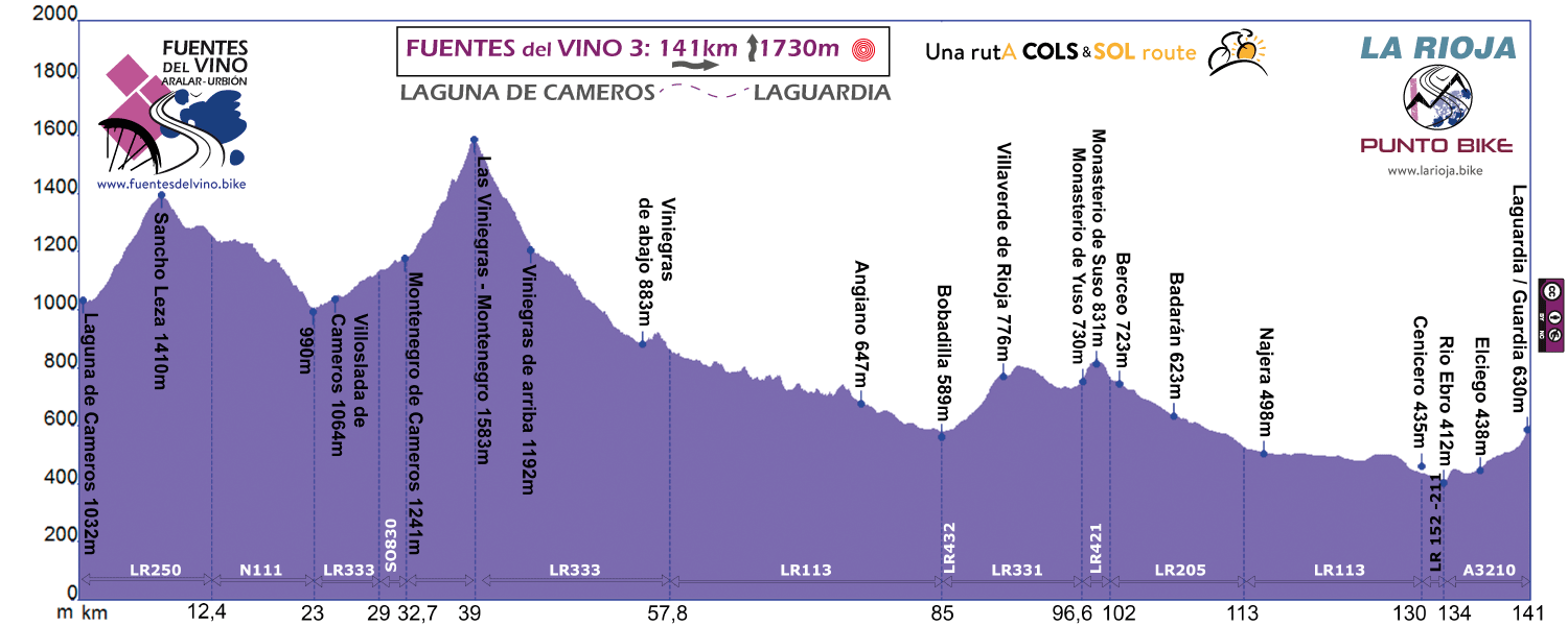
Stage 3
LAGUNA DE CAMEROS - LAGUARDIA
Distance: 141 / 120 km
Unevenness: 1.730 / 1.350 m
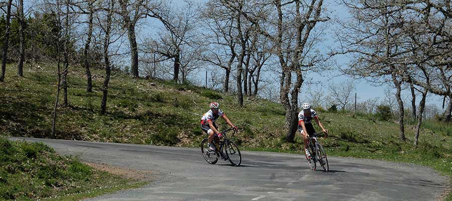
Queen stage. 2 high COLS, Sancho Leza and Las Viniegras. Yuso and Suso Monasteries, fancy wineries and the monumental city of Laguardia.
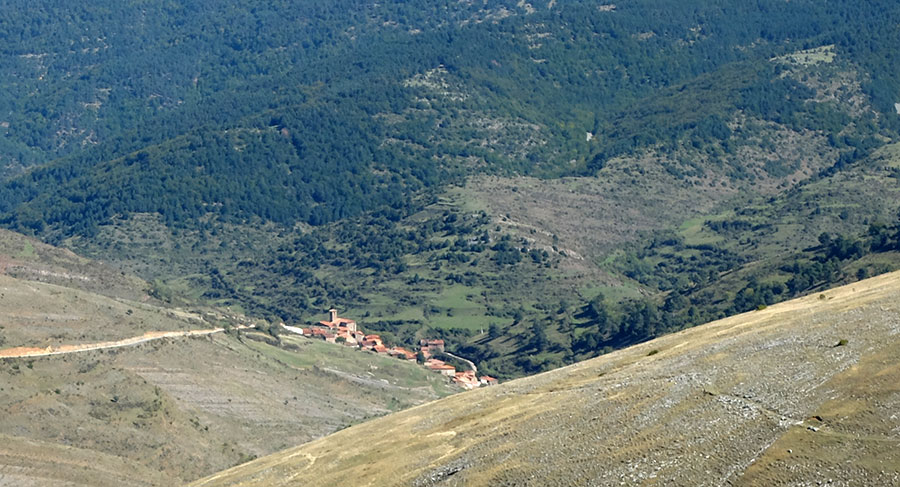
From Camero Viejo to Camero Nuevo, Cebollera rANGE and massif of Urbion.
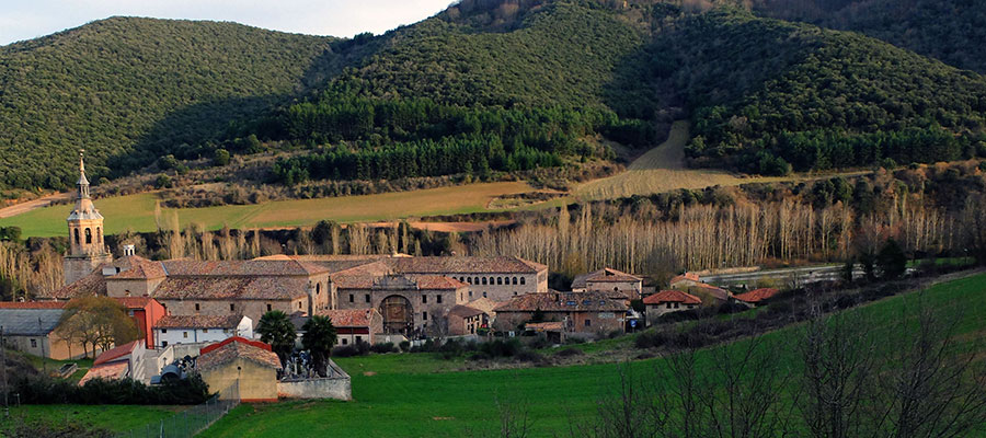
Long descents through the 7 villas among the impressive Najerilla canyons, and travel to the birthplace of Castilian, to the first words written in Basque and romance in the monasteries of Suso and Yuso de San Millan de la Cogolla, a World Heritage Site.
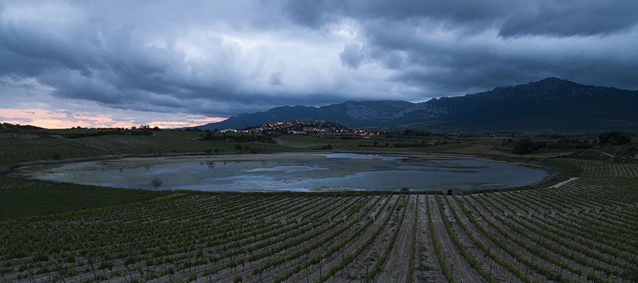
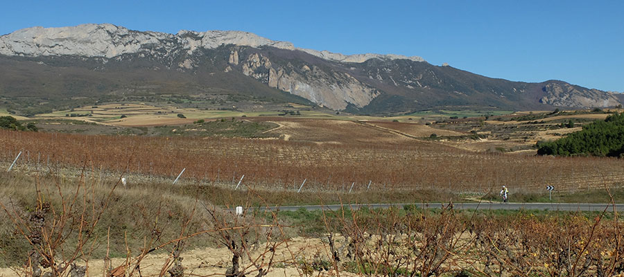
After, only Rioja, vineyards and more vineyards. The authentic wine territory.
Just as in the step above it is advisable to get up early. Especially if it is going to be hot.
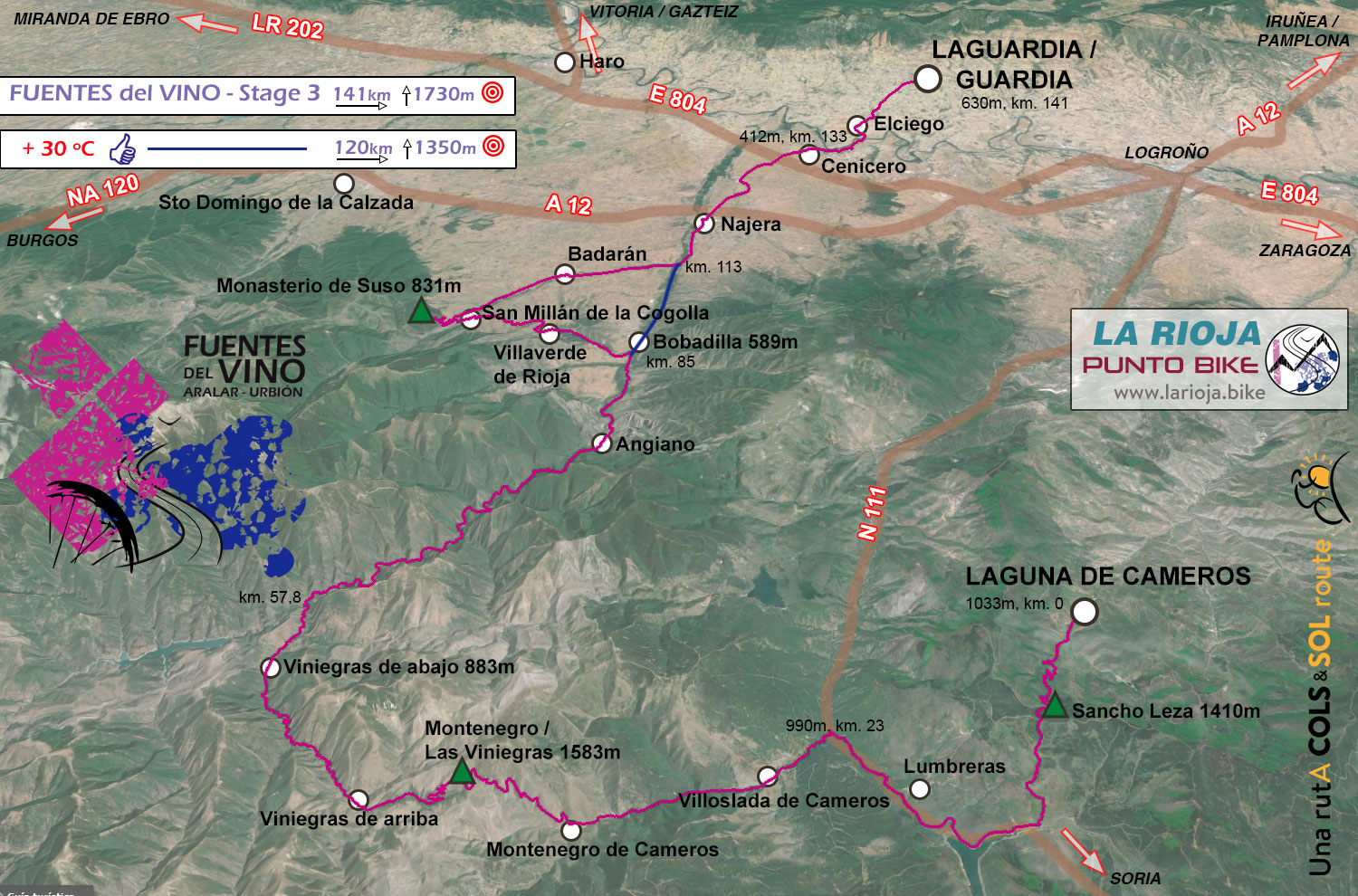
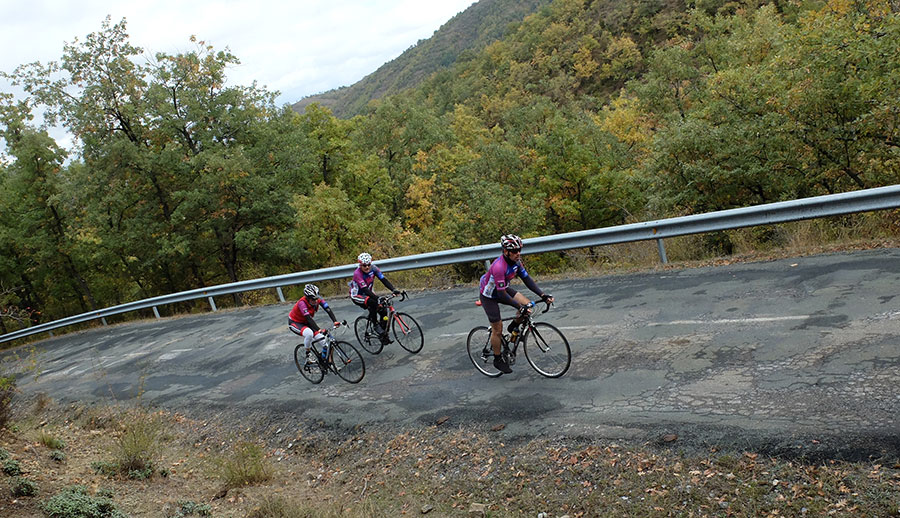
First difficulty of the day, Sancho Leza. We are entering the Sierra Cebollera.
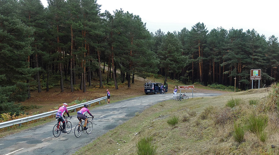
Top, rest and...
...to Montenegro. We are entering Soria - Montenegro de Cameros -
From the top of the port, Montenegro de Cameros, in the heart of the Sierra Cebollera.
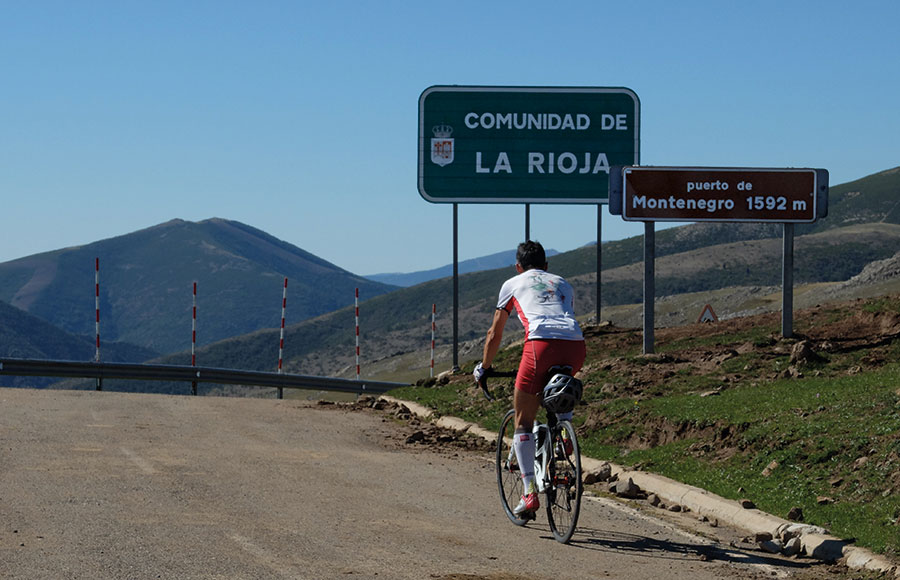
Return to La Rioja
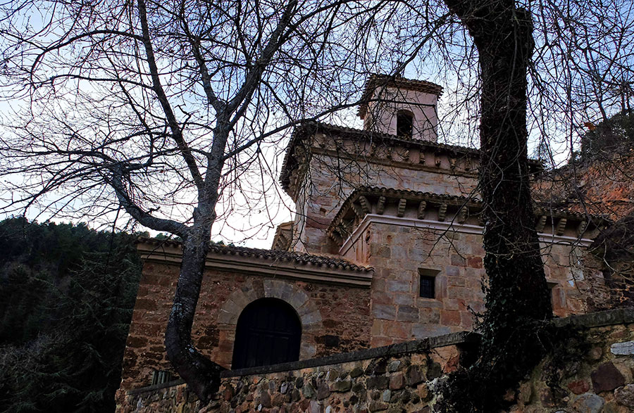
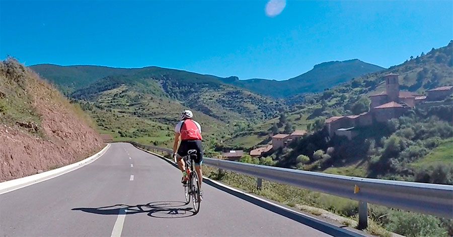
A small port, Monastery of Suso - World Heritage Site - founded by St. Millán in the 5th century.
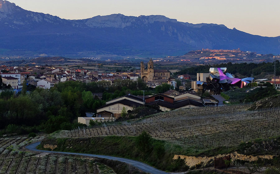
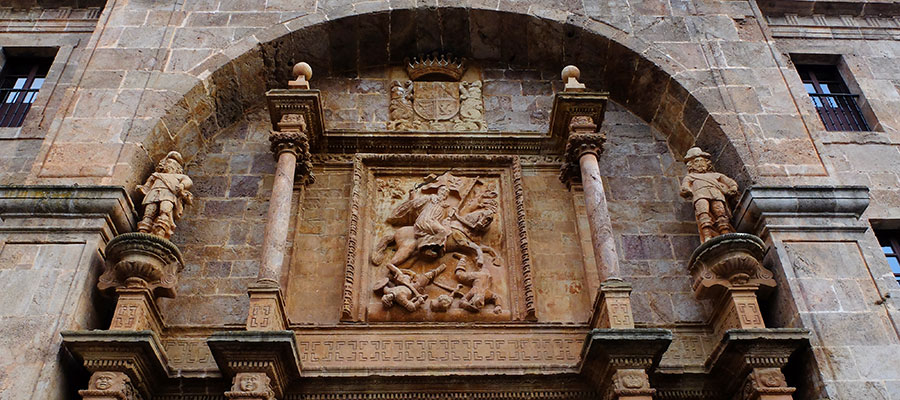
End of stage, Elciego, Marqués de Riscal Winery and Laguardia, our destination, with the last light of the day.
In the background one of the horizons of these days, the Sierra de Cantabria.
in preparation
Sancho Leza in altimetrias.net
Las Viniegras in altimetrias.net
If you want to see the route on wikiloc website click on the green icon on the map
Criteria used in the 6 levels that we have chosen for the ranking of the routes:
- Walks or family routes: Routes with light slopes and little travel. Suitable for untrained family groups or for people who usually don't use the bike
- Easy: Routes with a slope that can reach 1000 meters but facing none of the large ports.
The distance will range between 40 and 60 kilometers. - Moderate: Routes with one of the "great" ports or a combination of similar difficulty. The slopes can be really important and slopes can range between 1000 and 2000 meters.
The distance will vary between 60 and 100 kilometers. - Hard: Routes with a slope ranging around 2500 meters. There may have to ascend 2 ports of the "greats" or one and several of the "minor".
The distance will vary between 90 and 130 kilometers. - Very hard: Routes ranging from the 2500 and 4000 meters of altitude. Sometimes there may have to ascend the 3 ports of the '' greats ''.
The distance will exceed the 100 kilometers and may reach up to 200 km. - Challenge: In these times there is a public that demands "more" yet. To them arises the concept of "challenge": stages of more than a day in "non-stop" mode, 4500-5000 or even more meters of altitude routes, individual or group time trial with 3000 meters of altitude and over 100 kilometers of route.
Finally, a variety of what riders would usually call "nonsense" which to be more elegant, here we call it, 'Challenges'.
 Return